Sunday, 30 November 2014

What actually fell in 476?

I wrote the following many moons ago, but was reminded of it whilst reading a recent blog-post on the significance of AD 476. I'm posting it now just for the sake of interest—needless to say, this isn't a topic covered in my main research, nor something that I've looked into much in recent years! 

'The Roman Empire fell in 476', or something similar, is a phrase which often finds its way into popular history books, but there are many different interpretations as to what this means. Indeed, in order to fully understand what actually 'fell' in 476, we need to ask both what didn't fall then and what had already fallen before this date.


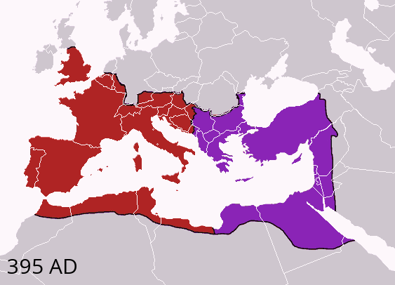
The Western and Eastern Roman Empires after c.AD 395 (source: Wikimedia Commons).

First and foremost, it does need to be remembered that a general belief that the Roman Empire fell in 476 can only ever work if one is willing to forget that the empire had been intermittently split into two halves ever since the later third century and that the eastern halfbased at Constantinoplecontinued in existence for nearly another 1000 years up to its final destruction in 1453. Although this 'Eastern Roman Empire' is known to most modern scholarship as the 'Byzantine Empire', this name was first coined in the mid-sixteenth century: in the medieval period it was usually known as the Imperium Romanorum, 'the Empire of the Romans', or Rhomania, 'the land of the Romans'. Indeed, in the Middle Ages the 'Byzantines' were usually considered by both themselves and outsiders to be quite simply Rhomaioi, 'Romans', living in Rhomania under an emperor whose official title was the Basileus ton Rhomaion, 'Emperor of the Romans'. In consequence, any claim that the Roman Empire as a whole ended in 476 is completely without foundation in face of the continuing imperial presence in Constantinople.

An animated gif of the varying extent of the 'Byzantine Empire', AD 476–1400 (source: Wikimedia Commons).

Given that a general notion that the Roman Empire ended in 476 cannot be sustained, what of a more specific one referring only to the end of Western Roman Empire? Can it be said that 476 was a key date in the end of a 'Romanised' western Europe and the fall of the Western Empire? Certainly with regards to the former point, the answer is probably no, 476 signified little in terms of the Roman 'character' of western Europe. Italy provides an obvious case study in this context, particularly during the time of Theoderic (AD 493–526). Here, in the ancient core of the Western Roman Empire, there remained strong ties to the Roman past through the later fifth and sixth centuries. Although political power had passed to the Ostrogoths, the administrative and taxation systems continued to be run by Romans in the Roman manner, and Roman judicial arrangements continued for the non-Gothic element of the population. Indeed, Theoderic appears to have adopted a deliberately Roman style of rule, with the resumption of the supply of corn to the masses and programs of reconstruction and rebuilding of public works such as bath-houses. In other words, the Italian state remained essentially Roman in structure and character, with the native population retaining its Roman culture; moreover, the 'barbarian' Goths actually became Romanised themselves over time, adopting Roman customs, language and religion.

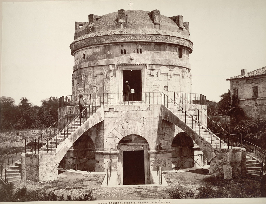
The mausoleum of Theoderic at Ravenna in the nineteenth century (Photo by Fratelli Alinari, c.1865–95)

Something similar appears to be the case with respect to the fifth- and sixth-century Visigothic kingdoms in Gaul and Spain. In Gaul, it has been argued that the Visigoths were settled directly onto the land and simply took over the empire's role in this area along with all of the governmental structures that this implies, with the result that Roman administration and aristocratic life and culture (including schools of higher education) was allowed to continue with free relations to the outside world, as witnessed by Gallo-Roman letter-writers such as Sidonius Apollinaris. In Spain, the Visigothic 'barbarian' successor state was even more 'Roman' in character than that in southern Gaul, due to the fact that, up until the 490s, the Visigoths didn't settle in this region but instead merely administered and garrisoned it. As Roger Collins has observed, the Visigoths effectively took over the role of the Praetorian Prefect and the Master of the Soldiers in Spain, leaving the rest of the society relatively untouched. Such continuity was not, of course, the case throughout the whole Western Empire—other areas, such as northern Gaul and Britain, exhibited far fewer Roman administrative and cultural features from the middle of the fifth century onwards. However, this only reinforces the core point, namely that there is no real evidence that 476 represented an unusually important date from the perspective of Roman-style governance and culture. Put simply, in Britain and northern Gaul the Roman administrative system and culture had already disappeared or declined severely by 476, whilst in Italy and Spain it seems to have continued to be a real force for many years after this date.

The question must therefore be, was 476 at least a key date in the fall of the Western Roman Empire as a political unit? The evidence here is a little more promising, as in 476 Italy itself ceased to be 'part' of the Western Roman Empire and instead became a 'barbarian' kingdom under Odovacer. If we are to pursue this line of reasoning, however, we must acknowledge that it was not until 480 that the Western Empire can officially be said to have fallen, as up until this point Julius Nepos continued to live as Western Emperor in Dalmatiaonly when this had ceased would the Eastern Emperor would recognise that the Western Roman Empire had truly fallen. Similarly we cannot say that the Roman Empire in the West fell around this date, as the 'barbarian' kingdoms remained, in theory at least, part of the Roman Empire. The creation of 'barbarian' kingdoms was seen as merely the delegation of practical authority in the areas of administration and defence to Imperial appointeesit was not seen as 'giving away' portions of the empire, and the Imperium Romanorum fully expected to be able to take back this delegated authority when it wished to do so (as in the case of the Visigoths, when Aëtius decided to try to do just this). Moreover, though the Western Empire may have ended, from the point of view of the Eastern Roman Empire, this merely meant that the Roman Empire was reunified and that the emperor in Constantinople 'inherited' all the theoretical rights that had belonged to the Western Emperor. The result of this is that, even though the unit known as the 'Western Empire' had ended, the 'successor' states continued to be, in constitutional theory, constituent elements of the Roman Empire. Thus, for example, Odovacer ruled Italy as a theoretical subject of the Eastern Emperor, Zeno (who made him a patrician), and Clovis, the king of the Franks in Gaul, apparently accepted the consulship from Emperor Anastasius in 508.

So, the Roman Empire certainly didn't cease to exist in 476, Roman-style governance and culture didn't suddenly disappear, and even the territory of the Western Roman Empire continued to betheoreticallyunder imperial jurisdiction. Nonetheless, 476 still has a modicum of legitimacy as a notional end-point, at least for the Western Roman Empire as distinct political unit, as after this date even Italy was no longer under its control. However, even here there are questions, not least whether the Western Roman Empire still existed in any meaningful form up until 476, or if it was just as ephemeral before Odovacer's conquest of Italy as the post-476 claims of imperial authority over the West were.

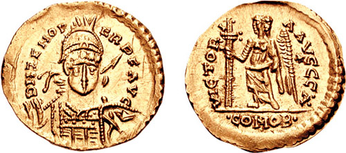
A solidus of Odovacer struck in the name of the Emperor Zeno, testifying to the formal submission of Odovacer to Zeno (source: Wikimedia Commons)

There are really two questions that must be answered in relation to the pre-476 Western Roman Empire. The first of these is, quite simply, how significant was the Western Empire in the years before 476? In the fourth century there seems to be very little evidence for any change in the nature of Roman power, rule or security; the army was still strong and the much-discussed 'barbarian' invasions posed very little problem for them except in times of civil-war. So, for example, the civil wars of 350–53 led to the abandonment of all the frontier forts north of Mainz with result that the Franks and the Alamanni invaded; nonetheless, the continuing strength of the Roman army was such that, once the internal difficulties were resolved, these 'barbarian' invasions were successfully dealt with. Indeed, for the most part the 'barbarian' incursions took the form of small-scale raids rather than invasions, and in 367 and 369 the Empire was able to lead armies in an offensive against the Goths.

By the fifth century, however, this situation had changed dramatically. The first indications of a change comes with the entry of the Visigoths into Roman territory in the late 370s, which seems to have taken the form of a full-scale tribal migration and attempt at settlement, rather than a transient raid. In the early fifth century such a situation becomes almost commonplace, with the Roman Empire seeing massive incursions into its territory by invading and migrating groups of 'barbarians', which far surpassed anything that the army had had to deal with previously. As to why this sudden change in the nature of the 'barbarian menace' occurred, Peter Heather has argued persuasively that the answer lies with the Huns. The Roman army seems to have been able to deal effectively with the 'barbarians' previously because they were usually raiders rather than settlers who were not united, attacking piecemeal. As such they presented the Empire with a manageable problem. The threat of the Huns seems, however, to have 'united' the 'barbarians' in a common causeto get away from the Huns by moving permanently within the borders of the Roman Empireand this meant that the advantage that the imperial army had previously enjoyed had ceased to exist.

Attila the Hun meeting Pope Leo, from a fourteenth-century miniature (source: Wikimedia Commons)

The result of this was that the Roman army was overwhelmed and alternative solutions other than the simple application of force had to be used in order to 'solve' these problems. Now the usual policy became one of calming the situation whilst, at the same, time saving face until arrangements could be made to deal with the 'barbarians' from a stronger position. So, in 418 a settlement was reached with the Visigoths that delegated political control of southern Gaul to them as 'political appointees' and then, over the next few decades, the Empire attempted to wrest this delegated control back. This would seem to be a sensibleand the only really viablepolicy given the situation, but it suffered from a continuity in Roman obsessions. In the fourth century, the Roman generals and rulers had usually preferred to deal with internal problems and struggles first before dealing with any 'barbarian' troubles, with (for example) the Frankish and Alamannic invasions left unchecked until internal hostilities had been resolved. Unfortunately, this ordering of priorities was retained despite the changed tactical situation. The result of this was that, whilst the Roman generals conducted their internal power struggles, the 'barbarians' secured their hold on the territories they had taken control of, including the economically vital province of Africa, which passed into the hands of the Vandals in the 430s. As a direct consequence of this situation, the Empire suffered a major decline in revenues, which meant that it was increasingly unable to support its army and was, therefore, increasingly incapable of retaking its 'delegated' territories as it intended toindeed, by the 450s there seems to have been no military force available to even protect Italy from the invading Huns.

The above description makes the nature of pre-476 rule appear to be much like that after 476, particularly from the 440s onwards when the aftershock of the loss of Africa starts really to be felt. This is not, of course, entirely true, as Rome and its empire still seem to have been important in and of itself to the 'barbarians' in this period, whilst after 476 it could be argued that the 'barbarians' found it merely convenient to subscribe to the myth of continuing Roman rule in the West as a way of legitimising their own rule. What we see is perhaps better characterised as a gradual decline throughout the fifth century from direct imperial control to increasing 'delegation' and eventual insignificance. Up to the 450s Rome still seems to have been respected and the focus of provincial loyalties, but its impotence in the face of the Huns led to attitudes slowly changing. After Aëtius's death, the Visigoths felt bold enough to sponsor their own Emperor (Avitus) and there is evidence of increasing numbers of Gallo-Romans switching allegiance away from Rome towards the Visigoths, who were obviously seen as being politically more significant than the Western Roman Empire in mid-fifth-century Gaul. By the 470s, it was deemed more advantageous for Ricimer's nephew and successor to compete for the control of the 'barbarian' Burgundian kingdom than to stay and support the puppet emperor Glycerius that he himself had set up, and in 475 Euric the Visigoth ignores the remnants of the Empire in favour of conquering Spain and Gaul. The polity that 'fell' in 476 thus cannot really be said to be any more than a pale shadow of what the Western Roman Empire had been. It was no longer a military power and it was of little importance beyond the use of its titles in legitimizing 'barbarian' rulethe Western Roman Empire's rule had become an anachronism and can probably be said to have been over for some time before Odovacer took control of Italy.

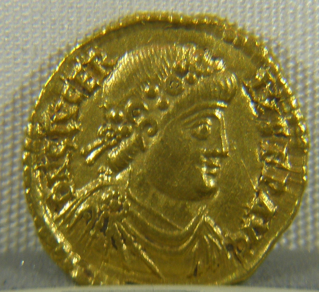
A coin of Glycerius, Western Roman Emperor from 473–4 (source: Wikimedia Commons)

Secondly, we must ask what was the nature of the Western Roman Empire itself? This is partly answered by the aboveit was an anachronism that seems to have been, in reality, dead for sometimebut we ought also to recall that part of the fundamental character of the Roman Empire was that it was ruled by an emperor who controlled the military forces and therefore the means of power. Indeed, many Roman emperors, including Constantine the Great, gained their position by rebelling against an existing emperor with the backing of a large number of troops, who then elevated them to the imperial throne. In the Western Roman Empire, however, there seems to have been an alteration to this basic definition of power within the state from the late fourth century onwards, with power devolving to the generals without the need for them to become emperor.

This process started with the reform of the army by Diocletian, who gave the command of frontier armies increasingly to professional soldiers instead of civilian provincial governors. This reform was then carried further by Constantine and his successors, who created a new, mobile army that wasn't linked to the frontiers and the high command of which was reorganised, with the civilian Praetorian Prefect's military authority being transferred to a Master of Cavalry (Magister equitum) and a Master of Infantry (Magister peditum). This did produce a more efficient army, but it also gave far more power to the generals too. In the Eastern Roman Empire this was less of a problem, as it was the seat of the 'senior' Emperor, who kept direct control of his forces. The Western Empire, however, was a different matter, as it was the seat of the 'junior' Emperor who was usually young, weak or weakened so as to prevent challenges to the Eastern Emperor's authority. Hence, for example, Valentinian II acted as a puppet for Emperor Theodosius, who separated the imperial person in the West from his military forces by giving control of the field army to General Arbogast. Needless to say, this was a very significant event. From this point, the Western Empire saw a series of 'military dictators' who held the real power, most notably Stilicho in the late fourth and early fifth centuries and Aëtius and Ricimer in the early to mid-fifth century. Indeed, the fact that these generals saw their position as preferable to that of the actual Western Emperor becomes increasingly obvious over this period. Arbogast, after the death of Valentinian II, raised Eugenius to the imperial rank in the West rather than himself; Stilicho was happy to remain as commander of the field armies rather than to depose the young Emperor Honorius; and from the 450s puppet emperors, set up by the generals, become very common indeed. In other words, in the Western Empire, men who would have in previous generations sought to make themselves emperor were now more often than not satisfied to remain generals in control of the military, rather than become the head of state.


A copy of an ivory diptych of Stilicho, right, and his family, carved c. AD 395 (source: Wikimedia Commons)

The inference to be taken from the above is, of course, that the rank of Roman emperor was no longer desirable in the West for most potential candidates, and that it was increasingly associated with weakness and puppet government. Power in the Western Empire rested rather with the man who controlled the armed forces, the Master of the Soldiers. Indeed, by the time we reach the 470s it becomes clear that these 'military dictators' no longer even feel a debt of loyalty to their puppet head of states. Gundobad, for example, was a Master of the Soldiers who installed the Emperor Glycerius on the throne, but in 473 he abandoned the Western Empire in order to compete for the control of the Burgundian kingdom. Not only was the de facto ruler of the Western Empire not the emperor, but the 'Master of the Soldiers' was only interested in his own power by this point—when the Western Empire became effectively irrelevant in contemporary politics, it was simply abandoned in favour of more advantageous posts.

In light of the above, we are in a position to answer the question of 'What actually fell in 476?'. It was not the basic governmental and cultural features of the Roman Empire in the West, which in some areas had disappeared long before and in others would survive for several generations; it was not the Imperium Romanorum itself, which continued to be based at Constantinople for nearly another 1000 years; and it was not the legal theory of Roman authority over the West, which seems to have been maintained by both the emperors in Constantinople and the 'barbarian' rulers of western Europe. What 'fell' in 476 was merely the political structure known as the Western Roman Empire, and even this had arguably 'fallen' many years previously. The Western Empire of 476 bore little resemblance to the polity that bore this name in the fourth century—it had very little power and virtually no influence; it was restricted to a few core areas; and its de facto ruler was the 'Master of the Soldiers', not the Western Roman Emperor. In other words, all that seems to have actually ended in 476 was the fiction that the Western Roman Empire still existed in any meaningful form whatsoever.

The content of this post and page, including any original illustrations, is Copyright © Caitlin R. Green, 2014, All Rights Reserved, and should not be used without permission.

Thursday, 20 November 2014

A 'Sorcerer's Stronghold' in Anglo-Saxon Nottinghamshire: Teversal, Sherwood... & Tolkien's Dol Guldur?

A previous post on this site looked at Teversham in Cambridgeshire (Teuresham in 1086), which is best interpreted as an early Anglo-Saxon place-name meaning 'the estate of the sorcerer', 'sorcerer' probably being the original sense of Old English *tēafrere/*tīefrere. Needless to say, such an origin is rather intriguing. Teversham does not, however, stand alone, and the following note is intended to examine the meaning and possible literary influence of another place-name that is believed to derive from the same first element as Teversham.

The location of Teversal, shown against a map of modern Nottinghamshire. Image drawn by C. R. Green, using a Creative Commons map from Wikimedia, contains Ordnance Survey data © Crown copyright and database right 2010; an approximate depiction of the extent of the medieval Sherwood Forest is also included, based on its extent in 1600 and the recorded medieval boundaries.

The place in question is Teversal, which is a village near to Mansfield (Nottinghamshire) that lay on the western edge of the medieval Sherwood Forest. Early forms of the name include Tevreshalt and Tevershald (1086), which seem to reflect the same first element as Teversham plus a different second element.(1) In the case of Teversham, the second element is Old English hām, 'estate or homestead', whereas in Teversal it appears to be Old English (ge)heald, Anglian hald, 'protection', probably here having the concrete sense of a 'stronghold' or 'refuge'.(2) As such, one credible interpretation of the name Teversal is that it originally meant 'the sorcerer's stronghold' and/or 'refuge'!

Such an explanation of the place-name Teversal naturally raises all sorts of interesting questions, although it does need to be recognised that other interpretations of the name are possible. For example, whilst the suffix in the name Teversham—Old English hām—suggests that the Cambridgeshire place-name is likely to date from the early Anglo-Saxon period and so was probably coined at a time when Old English *tēafrere/*tīefrere still retained its original sense of 'sorcerer', rather than the later secondary sense of 'painter', the situation is not so clear with regard to Teversal.(3) Anglian hald lacks such generally agreed chronological implications as hām and so the name Teversal could have been coined rather later than Teversham is usually believed to have been—consequently, a meaning of 'painter', rather than 'sorcerer', for the first element is perhaps more plausible for the Nottinghamshire name than it is for Teversham. Nonetheless, despite such concerns, Ekwall, Watts and other commentators clearly consider that a reading of Teversal as 'the sorcerer's stronghold' is still perfectly acceptable.(4)

If we thus have potential place-name evidence for an Anglo-Saxon 'sorcerer's stronghold' (and/or 'refuge') that was located on what was the western edge of one of the great forests of medieval legend, Sherwood, what else can we say about this? Whilst we cannot now know what real-life context lay behind the coining of such a name, I have to say that I find it a little difficult not to think of J. R. R. Tolkien's Dol Guldur when considering the above etymology for Teversal! For example, just as Teversal can be read as 'the sorcerer's stronghold', so too is Dol Guldur described in The HobbitThe Lord of the Rings and Unfinished Tales as a 'dark tower' of a 'black sorcerer', the 'dark hold' of 'the Necromancer', 'the stronghold of the Enemy in the North', and 'the first stronghold of Sauron'. In other words, 'the sorcerer's stronghold' is a description that would fit Dol Guldur very well, and Tolkien does, in fact, use the relatively rare and archaic Modern English form of Old English (ge)heald, Anglian hald, to refer to this fortress in The Hobbit when he calls Dol Guldur a 'dark hold'!(5) Similarly, both Teversal and Dol Guldur are located on or near to the western edge of great legendary forests, Sherwood in the case of Teversal, Mirkwood in the case of Dol Guldur, with the name of the latter reflecting, for Tolkien, Old English mirce, 'darkness, mirk', a word that is identical in form to Old English Mirce, 'the Mercians', within whose kingdom Sherwood Forest was once located.(6) And, finally, just as Teversal might be read as either 'the sorcerer's stronghold' or 'the sorcerer's refuge', so too is it clear that Dol Guldur was both a stronghold and a place of refuge for its master. It was to here, after all, that the 'dark sorcerer'—Sauron, the Necromancer—retreated and where he lay hidden for many years, in order that he might regain his 'shape and power' in secrecy after his defeat by the Last Alliance at the end of the Second Age (e.g. Lord of the Rings, Book 2, chapter II).

This could, of course, all be mere coincidence, but it is diverting to wonder if this is necessarily the case. After all, Tolkien was a gifted philologist and Anglo-Saxonist, plus he had an aunt in Nottinghamshire, Jane Neave, with whom he stayed for a formative period in 1914.(7) In such circumstances, it is tempting to speculate—and speculate is very much the word here!—that a knowledge of Teversal as a potential 'sorcerer's stronghold' and/or 'refuge' on the edge of Sherwood Forest might have contributed to Tolkien's concept of Dol Guldur as a sorcerer's stronghold near the western edge of Mirkwood. Whilst Ekwall didn't publish his etymology of Teversal until 1936—only a year before The Hobbit appeared—he and Tolkien were professional colleagues who knew each other and, as such, it is by no means impossible that Tolkien might have encountered Ekwall's etymology sufficiently long before its publication to have been influenced by it when working on The Hobbit, although the case obviously cannot be proven at present.(8)


Notes

1    E. Ekwall, The Concise Oxford Dictionary of English Place-Names, 4th edn (Oxford, 1960), p. 464; V. Watts, The Cambridge Dictionary of English Place-Names (Cambridge, 2004), p. 605.
2    E. Ekwall, Studies in English Place-Names (Stockholm, 1936), pp. 54–5; Ekwall, Oxford Dictionary, p. 464; A. H. Smith, English Place-Name Elements (Cambridge, 1956), vol. 1, p. 222.
3    On the development of the first element in the names Teversham and Teversal, see the previous post on Teversham and Watts, Cambridge Dictionary, p. 604. On the dating of hām names, see, for example, B. Cox, 'The significance of the distribution of English place-names in -hām in the Midlands and East Anglia', Journal of the English Place-Name Society, 5 (1972–3), 15–73, and J. Insley, 'Siedlungsnamen §2. Englische', Reallexikon der Germanischen Altertumskunde, 28 (2005), 344–53, especially pp. 346–7.
4    Ekwall, Studies, p. 55; Ekwall, Oxford Dictionary, p. 464; A. D. Mills, A Dictionary of English Place-Names (Oxford, 1991), p. 323; Watts, Cambridge Dictionary, p. 605.
5    W. G. Hammond & C. Scull, The Lord of the Rings: A Reader's Companion (London, 2005), pp. 237, 310—see J. R. R. Tolkien, The Hobbit (London, 1937), chapters 1 and 19; J. R. R. Tolkien, The Fellowship of the Ring (London, 1954), Book 2, chapter ii; J. R. R. Tolkien, Unfinished Tales (London, 1980), p. 280, n. 12. On 'hold' and Old English (ge)heald/Anglian hald, see Oxford English Dictionary, 'hold, n.1'.
6    See the map of Mirkwood included in The Lord of the Rings. On Tolkien's Mirkwood and its roots, see P. Gilliver et al (eds.), The Ring of Words: Tolkien and the Oxford English Dictionary (Oxford, 2006), p. 165; Hammond & Scull, Reader's Companion, pp. 12–13; J. Evans, 'Mirkwood', in M. D. C. Drout (ed.), J.R.R. Tolkien Encyclopedia: Scholarship and Critical Assessment (New York, 2007), pp. 429–30; T. Shippey, 'Tolkien, medievalism, and the philological tradition', in I. Moskowich-Spiegel & B. Crespo-García (eds.), Bells Chiming from the Past: Cultural and Linguistic Studies on Early English (Amsterdam & New York, 2007), pp. 265–79 at p. 277; and J. R. R. Tolkien, The Legend of Sigurd and Gudrún (London, 2009), pp. 227–8. See also J. Bosworth, An Anglo-Saxon Dictionary, ed. T. N. Toller (Oxford, 1898), p. 689.
7    C. Duriez, 'Neave, Jane', in M. D. C. Drout (ed.), J.R.R. Tolkien Encyclopedia: Scholarship and Critical Assessment (New York, 2007), p. 455; on Tolkien as a philologist and Anglo-Saxonist, see for example Gilliver et al, Ring of Words, and T. Shippey, The Road to Middle-Earth, 2nd edn (London, 1992).
8    On Tolkien and Ekwall, see for example Tolkien's reviews of some of Ekwall's key works in the 1920s and his role as a signatory to the introductory note included in the 1942 Festschrift in honour of Ekwall's sixty-fifth birthday: S. B. Liljegren & J. Melander (eds.), A Philological Miscellany Presented to Eilert Ekwall (Uppsala, 1942). The etymology for Teversal discussed here was published in Ekwall's 1936 Studies in English Place-Names, pp. 54–5, and also presumably in the 1936 first edition of Ekwall's Oxford Dictionary (it appears on p. 464 of my fourth edition, published in 1960). Note, whilst Tolkien's Guldur, 'sorcery, dark sorcery' (Hammond & Scull, Reader's Companion, p. 237) does not resemble Old English tēafor/*tēafrere, 'sorcery/sorcerer', in form, it does resemble another Old English word that relates to magic and magical practices, galdor, 'an incantation' (cf. Old Norse galdr): Bosworth & Toller, Anglo-Saxon Dictionary, p. 359.

The content of this post and page, including any original illustrations, is Copyright © Caitlin R. Green, 2014, All Rights Reserved, and should not be used without permission.

Sunday, 2 November 2014

Stain Hill and the Lincolnshire Marshes in the Anglo-Saxon period

The following post offers both a draft map of the landscape of the Lincolnshire Marshes in the early Anglo-Saxon and Middle Saxon periods and a brief discussion of finds of this period that have been made at Stain Hill, Withern, a site that lies in the heart of the Lincolnshire Outmarsh.

The Lincolnshire Marshes in the pre-Viking period (drawn by C. R. Green, contains British Geological Survey materials © NERC 2014). Louth is marked on the map to aid with location. Light blue represents freshwater wetlands and saltmarsh, whilst dark blue is used for the sea and main creeks/rivers in this region. Key sources of information used in its creation include the British Geological Survey's maps of this region; D. N. Robinson's map of Lincolnshire's 'Saxon Shoreline' from The Book of the Lincolnshire Seaside (Buckingham, 1981); H. Fenwick, The Lincolnshire Marsh: Landscape Evolution, Settlement Development and the Salt Industry (PhD Thesis, University of Hull, 2007); N. G. Berridge and J. Pattison, Geology of the Country Around Grimsby and Patrington (London, 1994); and the 1628 (Mercator) and 1645 (Blaeu) maps of Lincolnshire.

Looking at the above map, several features deserve comment, not least the extensive wetlands that are depicted on the east coast of Lincolnshire and south of the Wolds. That there was a significant late/post-Roman marine transgression in Lincolnshire, which is usually dated to the fourth–sixth centuries AD, is now well-established—indeed, Romano-British sites on Lincolnshire Marshes appear to have been buried under several metres of marine alluvium at this time, with a Romano-British site at Scupholme, to the east of Louth, found beneath more than three metres of alluvium deposited by the sea and Romano-British salterns at Ingoldmells smothered by two to three metres of silt. The modern Outmarsh surface (the light blue area between Grimsby and Skegness) is believed to have its origins in these late/post-Roman deposits and the whole area was probably still largely wetland—primarily saltmarsh, although with peat to the south of the Wolds, see figure below—throughout much of the pre-Viking period, a situation depicted on the above map.

The maximum extent of the late/post-Roman marine transgression; click image for a larger version. Wetlands to the south and east of this line were probably saltmarsh throughout the pre-Viking period; those to the north and west of it were probably freshwater. Drawn by C. R. Green, as above; boundary of the maximum marine transgression after D. S. Brew et al, 'Holocene sedimentary evolution and palaeocoastlines of the Fenland embayment, eastern England', in I. Shennan et al (eds), Holocene land-ocean interaction and environmental change around the North Sea (London, 2000), pp. 253–73 at p. 270 (fig. 27). Note, I. G. Simmons, 'Creating dry land in S.E. Lindsey (Lincolnshire, England) before AD 1550', Water History, 6 (2014), 211–25 at pp. 211–12, suggests that the marine transgression reached up to c. 6.7m OD, a height that would have led to a much more extensive marine incursion than that depicted here. However, this level seems implausibly high given what we know of Holocene sea-level rise and, on checking the referenced works, the evidence for it is weak; as such, it is rejected here.

Also worthy of note are the 'islands' visible within both the coastal wetlands of the Outmarsh and the sea. These 'islands' have several different explanations. Those located in the sea were offshore coastal barrier islands that protected the coast of Lincolnshire until their probable destruction by the sea in the thirteenth century. Those depicted as lying at the edge of the coastal wetlands are raised sand ridges and ancient storm beaches that appear to have been above the maximum height of the late/post-Roman marine transgression. For example, a detailed study of the northern part of the Outmarsh suggests that there were two persistent sand bodies here from prehistory onwards: the southern sand body (in the North Somercotes–Saltfleet area) largely rose above the maximum height of the sea during the post-Roman period, whilst the northern instance was mostly buried by alluvium deposited during the late/post-Roman marine transgression, with the possible exception of some areas of it that lay to the east of Marshchapel. Also shown is a probable sand ridge in the Skegness area, following David Robinson, not least because there now seems to be reasonable evidence for a Roman site of some significance at Skegness or just offshore from it that was probably the origin of Old Skegness, a 'towne waullid having also a castelle' that was destroyed by the sea around 500 years ago.

Finally, those islands that are shown as lying within the Outmarsh were true islands of dry land within the Anglo-Saxon coastal wetlands, being exposed glacial deposits that stood above the surrounding saltmarshes. Several of these islands have evidence indicative of Anglo-Saxon period activity, including an early Anglo-Saxon to Middle Saxon settlement and Middle Saxon to Late Saxon cemetery excavated in the 1990s at Cumberworth. However, perhaps the most interesting example is an unexcavated site located a little further north in the Outmarsh, at Stain Hill in Withern with Stain parish, the site of the Deserted Medieval Village of Stain.

The location of Stain Hill in the Anglo-Saxon Outmarsh (drawn by C. R. Green, as above).

This island of glacial till and gravel rises from the surrounding marine alluvium to reach a maximum height of 9m OD and has been the site of a number of interesting finds. The earliest material known from here consists of prehistoric worked flints, but the interest for us starts in the Romano-British era with a total of 53 late fourth-century Roman coins (Gratian to Valentinian II, 367–92) found at Stain Hill as an artefact scatter (rather than a hoard). Within the local context, this is a very significant quantity. A survey of 314 km² of Lincolnshire Wolds and Marsh around Louth revealed that most recorded Roman coin concentrations in this part of Lincolnshire rarely broke into double figures, with just three sites reporting more than 12 coins and only a single site having more than 40, the latter being the important probable villa and estate centre at Welton le Wold (the topic of a future post on this blog). Such a conclusion is supported by Helen Fenwick's survey of Roman finds from the Outmarsh recorded in the Lincolnshire Historic Environment Record and an examination of the Portable Antiquities Scheme data for the Outmarsh. In both cases, the Stain Hill material stands out as amongst the most significant finds of non-hoarded Roman coins known from the entire Outmarsh, with most coin concentrations again only very rarely entering into double figures. In light of the above, the 53 coins from Stain Hill appear extremely interesting and could well be indicative of the presence of a significant late fourth-century Romano-British site at Stain Hill. Indeed, in this context the name 'Stain' may also be relevant, as Arthur Owen has suggested that place-names involving Old English stān or Scandinavian steinn, 'stone', were given to places where there were once obvious Roman remains, such as standing structures or stone building debris.

The geology of Stain Hill and the surrounding area, set against a present-day streetmap; click image to view a larger version. Yellow represents marine alluvium; green Devensian glacial till, and purple Devensian glaciofluvial deposits. Image taken from the BGS Geology of Britain Viewer, licensed under an Open Government Licence 2.0: contains British Geological Survey materials © NERC 2014.

A detailed image of Stain Hill, showing the island of glacial till surrounded by marine alluvium (from the previous image) set against the 1905 OS map of Stain Hill. Also depicted are cropmarks that seem to be visible on the Google Maps aerial photograph of the area as of November 2014 (in red) and an indication of the approximate area that the 53 Late Roman coins were found (purple, reflecting the general 6 figure grid-reference recorded for these on the HER). Some of the cropmarks clearly reflect pre-modern field boundaries, visible on the 1905 map but since removed; others do not, however. A proportion of the latter relate to the medieval moated site in the bottom left of the image, whilst those in the area where the Roman coins were found might bear comparison with Roman-era settlement cropmarks from elsewhere in eastern Lincolnshire, including one that looks like a form of large rectilinear enclosure with regular internal divisions that is found associated with villas and small Roman 'towns' here, see D. Jones, 'Romano-British Settlements on the Lincolnshire Wolds', in R. H. Bewley (ed.), Lincolnshire's Archaeology from the Air (Lincoln, 1998), pp. 69–80 (my thanks to Adam Daubney for discussing these cropmarks with me).

Moving into the post-Roman period, Stain Hill appears equally interesting. In 1988, the metal detectorist who found the Roman coins also reported a significant quantity of Anglo-Saxon material to the Lincolnshire Historic Environment Record that had been found at Stain Hill, including 17 'Saxon' pin heads and 2 strap-ends. Although no additional reports were received by the Lincolnshire HER, further finds were reported by the same detectorist to Scunthorpe Museum,(1) so that the final record of pre-Viking finds made from the site—which must represent a minimum assemblage, as the site was apparently once regularly detected by multiple people—include 2 early Anglo-Saxon artefacts, 22 Middle Saxon pins, 6 Middle Saxon strap-ends, and 7 Middle Saxon coins (consisting of 3 sceattas, 3 Mercian pennies and an early ninth-century coin of Wulfred, Archbishop of Canterbury; the sceat recorded by Mark Blackburn as having been found 'near Mablethorpe' may well have come from this site too). There were also apparently finds of a Anglo-Scandinavian Ringerike-style stirrup mount and a Late Saxon penny.

Once again, this is a very notable concentration of material, and one that encompasses the early Anglo-Saxon, Middle Saxon and Late Saxon/Anglo-Scandinavian periods. And, as before, a consideration of the HER and PAS data suggests that the Stain Hill finds are conspicuous within their local landscape context, being both the largest concentration of pre-Viking metal-detected material known from within the Outmarsh and indicative of activity that continued here over a number of centuries. Quite what this activity was is open to debate, however. It could be that there was an occasional trading or market site here, although as there appears to have been a very significant site of this type or similar only a handful of miles away on the edge of Middle Marsh, this may not be the most plausible solution. Alternatively, and perhaps more credibly, these items might indicate the presence of some sort of significant settlement or potential local estate centre which exploited the surrounding saltmarsh and coastal resources of the pre-Viking Outmarsh.

In this context, it is worth noting that just over 3 miles to the south-west of Stain Hill is the modern parish of Sutton on Sea, Sudtone in 1086. This is an Old English place-name that means 'the south farm or village' and it is of a type that is usually believed to imply that the farm or settlement in question was a subordinate part of a complex pre-Viking estate and that it was located to the south of a more important settlement (the estate centre). Needless to say, given the character of the likely pre-Viking landscape in this area; the location of Stain Hill in relation to Sutton on Sea; the nature of the other place-names that lie to the north of Sutton (all ‑thorp names, indicating that they were, in the Anglo-Scandinavian era, secondary settlements and outlying farmsteads); and, of course, the available archaeological evidence, Stain Hill must represent a good candidate for the estate centre/settlement that Sutton was named in relation to and was a subordinate part of the estate of.

An early ninth-century penny of Wulfred, Archbishop of Camterbury, similar to that found at Stain Hill (the example pictured here was found in Oxfordshire; image courtesy of the Portable Antiquities Scheme)

Needless to say, if the material found at the Deserted Medieval Village of Stain may thus reflect Stain having been originally some sort of pre-Viking local estate centre, located on an Outmarsh island surrounded by valuable wetland resources, then it has to be wondered whether or not this settlement and its potential local centrality might represent some sort of continuity with the Late Roman past? After all, the Roman finds we have from Stain do suggest that there was a locally important Late Roman settlement here and, as was noted above, it is possible that the name 'Stain' was given in reference to still-obvious Romano-British buildings/materials at this site. Whilst such questions are difficult to answer definitively, the evidence we have certainly appears suggestive in this regard. Indeed, not only has the site produced finds from the Late Roman, early Anglo-Saxon, Middle Saxon and Late Saxon/Anglo-Scandinavian periods, and looks to have been locally significant in both the Late Roman and the pre-Viking eras, but it is also worth noting that such a degree of continuity would be more than plausible within the wider context of post-Roman activity and continuity in Lincolnshire.


Notes

1    My thanks are due here to Dr Kevin Leahy, formerly of Scunthorpe Museum and now of the Portable Antiquities Scheme, and Mike Hemblade, of the North Lincolnshire Historic Environment Record, for providing me with details of these finds.

The content of this post and page, including any original illustrations, is Copyright © Caitlin R. Green, 2014, All Rights Reserved, and should not be used without permission.

Tuesday, 28 October 2014

An early Anglo-Saxon sorcerer at Teversham, Cambridgeshire?

An earlier post on this site looked at some possible place-name evidence for pagan priests and Kultverbände or cultic groups in early Anglo-Saxon Lincolnshire and East Anglia. The following post briefly examines a further place-name that may be of some relevance in this regard.

The location of Teversham, set against a map of the post-Roman landscape eastern England and some of the Willingham and Ingham names discussed in the previous post (drawn by C. R. Green).

The place-name in question is Teversham, near Cambridge, a name that contains the Old English element hām, 'estate or homestead', and so is of a type that is often thought to date from the early Anglo-Saxon period, perhaps being coined in the fifth or sixth century.(1) Early forms of this name include Teuuresham (1042x66) and Teuresham (1086) and it is usually stated to involve either an Old English personal name *Tēofer or, more commonly, an occupational term *tēafrere/*tīefrere, 'painter', combined with hām. So far, so prosaic, one might be inclined to think. However, the first element in this name is rather more interesting than it might first appear to be. As Victor Watts has observed, 'the cognates of both Tēofer and tēafrere are associated in other Germanic languages with magic', a point reinforced by John Insley, who remarks that Old English *tēafrere, 'painter', is 'a word which belongs to the same root as Old High German zoupar n. "magic, sorcery"'.(2) Similarly, Eilert Ekwall long ago commented that:
Old English tīefran ['to paint'] corresponds to German zauburn, Dutch tooveren 'to practice sorcery', and Old English tēafor 'red pigment' to Old High German zoubar, Old Frisian tāver, Old Norse taufr, 'sorcery'.(3)
As such, all may well not be quite what it seems with regard to the first element in the place-name Teversham. In this regard, it should be noted that Watts clearly considers the meanings sorcery/to practice sorcery/sorcerer and so forth 'to have been the original sense' here, indicating that the meanings of red pigment/to paint/painter and the like are probably a secondary, later sense and 'developed from the practice of staining magic runes this colour [i.e. red]'.(4) Given the fact that the name Teversham is usually believed to have had its origins very early within the Anglo-Saxon period, this must be considered a point of some considerable significance. Indeed, Ekwall does, in fact, carry on from his analysis quoted above to argue in his discussion of the place-name Teversham that 'Old English tīefran may well have been used in the sense "to practice sorcery", and tīefrere in the sense "sorcerer"'.(5) In other words, a consideration of the likely meaning, usage and history of the first element of Teversham suggests that this place-name can perhaps be best understood as meaning originally 'the estate/homestead of the sorcerer', an etymology that has been endorsed as a real possibility by not only Ekwall, but also both Watts and Insley.(6)

A potential origin for Teversham in 'the estate/homestead of the sorcerer' is, of course, most intriguing. With regard to the interpretation of such an etymology, it is worth reiterating the point made at the start of this post, namely that Teversham is a major place-name of a type often thought to date from the early Anglo-Saxon period, perhaps being coined in the fifth or sixth century—or 'the pagan period', as it was once more commonly known.(7) In consequence, if Teversham does indeed mean 'the hām of the sorcerer', as argued above, then the name would probably have been meant literally: that is to say, that it would have denoted a significant estate (or homestead) belonging to someone who was considered a sorcerer in the early Anglo-Saxon period. Needless to say, in such circumstances, John Insley's suggestion that Teversham is 'a name... with possible cultic implications'(8) would certainly seem worthy of some serious consideration.


Notes

1    See, for example, B. Cox, 'The significance of the distribution of English place-names in -hām in the Midlands and East Anglia', Journal of the English Place-Name Society, 5 (1972–3), 15–73; J. Kuurman, 'An examination of the ‑ingas‑inga‑ place-names in the East Midlands', Journal of the English Place-Name Society, 7 (1974–5), 11–44; B. Cox, ‘The place-names of the earliest English records’, Journal of the English Place-Name Society, 8 (1976), 12–66; M. Gelling, ‘English place-names derived from the compound wīchām’ reprinted in K. Cameron (ed.), Place-name Evidence for the Anglo-Saxon Invasion and Scandinavian Settlements (Nottingham, 1977), pp. 8–26; K. Cameron, English Place Names, 2nd edn (London, 1996), pp. 70–1, 141; J. Insley, 'Siedlungsnamen §2. Englische', Reallexikon der Germanischen Altertumskunde, 28 (2005), 344–53, especially pp. 346–7.
2    V. Watts, The Cambridge Dictionary of English Place-Names (Cambridge, 2004), p. 605; J. Insley, 'Siedlungsnamen', 347. Note, the abbreviations included in these quotations and those that follow are expanded here for the convenience of the reader.
3    E. Ekwall, The Concise Oxford Dictionary of English Place-Names, 4th edn (Oxford, 1960), p. 464.
4    Watts, Cambridge Dictionary, p. 604.
5    Ekwall, Oxford Dictionary, p. 464.
6    Ekwall, Oxford Dictionary, p. 464; Watts, Cambridge Dictionary, p. 605; Insley, 'Siedlungsnamen', 347.
7    As in Cox, 'Distribution of English place-names in -hām', passim.
8    Insley, 'Siedlungsnamen', 347.

The content of this post and page, including any original illustrations, is Copyright © Caitlin R. Green, 2014, All Rights Reserved, and should not be used without permission.

Sunday, 26 October 2014

Anglo-Saxon archaeology, Late Roman provinces & the landscape of post-Roman eastern Britain

The first aim of this post is simply to share an interesting map of post-Roman Britain. The map in question plots 'Anglian' cremation-predominant cemeteries against both 'Saxon' artefacts of the second half of the fifth century and the Late Roman provincial boundaries (after J. C. Mann), and is one of a pair of images that were designed to illustrate a brief discussion of the supposed early Anglian and Saxon cultural areas and the potential relationship of these to the Late Roman provinces of Britain.(1)

The distribution of early Anglian cremation-predominant cemeteries, represented by filled squares, plotted against Saxon artefacts of the second half of the fifth century, represented by stars, and the Late Roman provincial boundaries. Image credit: C. R. Green; published as Green, Britons and Anglo-Saxons, 2012, fig, 21a.

This map is, I hope, reasonably self-explanatory and requires little detailed comment here, other than to note that the distribution of the Anglo-Saxon material depicted in it would indeed seem to offer a degree of support to suggestions that early Anglian and Saxon settlement in eastern Britain may have been, initially at least, influenced by the Late Roman provincial arrangements.(2)

The above map was, of course, made using the modern coastline as a background. Whilst this perhaps enables patterns to be seen more easily and the reader to locate themselves more quickly, it is worth recalling that the landscape of eastern Britain in the post-Roman period is likely to have looked rather different to that of the twenty-first century. The second aim of this post is therefore to share another map, newly created, that is designed to give an idea of what the landscape of this region in the post-Roman period may have looked like. For the sake of convenience, it once again shows the Anglian cremation-predominant cemeteries plotted alongside the Late Roman provinces, but now sets this material against the likely post-Roman landscape.

A very rough draft of a map of the likely post-Roman landscape of eastern England, drawn by C. R. Green. Dark blue represents the sea, green permanently dry land, and light blue the wetlands and salt-marshes; the siltland around the Wash is striped to reflect its low-lying nature and origin as marine deposits in this period. Also shown are early Anglian cremation pre-dominant cemeteries (black dots) and the Late Roman provinces (dotted lines).

This image has a number of significant differences from the modern map. For example, it features the offshore coastal barrier islands that once protected the coast of Lincolnshire, before their probable destruction by the sea in the thirteenth century.(3) It also depicts the post-Roman wetlands in the Fenland, the Humber Wetlands, the Lincolnshire Marsh and the Norfolk Broadland (the latter had probably largely become wetland—rather than estuary—by c. AD 500, aside from in Breydon Water).(4) And, finally, it features an adjusted eastern sea coast that takes account of erosion and coastal change in Holderness, the Wash area and East Anglia since the early medieval period.(5) Needless to say, the resultant map offers a rather different view of post-Roman eastern Britain and will form the base map for any future posts that look at this region in that period.


Notes

1    The map included here was published in Green, Britons and Anglo-Saxons: Lincolnshire AD 400–650 (Lincoln, 2012), as fig. 21a (the other image mentioned was published as fig. 21b in the same volume), which also discusses its sources and implications in more depth at pp. 93–5, 113, 152; further details of Britons and Anglo-Saxons are available here. The map reproduced here has also been used, with permission, by N. J. Higham & M. Ryan, The Anglo-Saxon World (New Haven & London, 2013), as their fig. 2.27a. The depiction of the Late Roman provinces on this map and the following one is after J. C. Mann's important article, 'The creation of four provinces in Britain by Diocletian', Britannia, 29 (1998), 339–41.
2    See further on all of this Green, Britons and Anglo-Saxons, pp. 93–5, 113, 152, and also B. Yorke, 'Anglo-Saxon gentes and regna' in H-W. Goetz et al (eds), Regna and Gentes: The Relationship Between Late Antique and Early Medieval Peoples and Kingdoms in the Transformation of the Roman World (Leiden, 2003), pp. 381–408 at 397–9.
3    These coastal barrier islands were first suggested by H. H. Swinnerton, 'The post-glacial deposits of the Lincolnshire coast', Quarterly Journal of the Geological Society, 87 (1931), 360–75. See also D. N. Robinson, The Book of the Lincolnshire Seaside (Buckingham, 1981), pp. 13, 17 (map), 20; Institute of Estuarine and Coastal Studies, Humber Estuary & Coast (Hull, 1994), p. 33; and Natural England, NA 101: Bridlington to Skegness Maritime Natural Area Profile (Sheffield, 2013), pp. 11, 21.
4    For example, A. Crowson et al (eds), Anglo-Saxon Settlement on the Siltland of Eastern England (Heckington, 2005); R. Van der Noort, The Humber Wetlands: The Archaeology of a Dynamic Landscape (Macclesfield, 2004); R. Van der Noort, 'Where are Yorkshire's "terps"? Wetland exploitation in the early medieval period', in H. Geake & J. Kenny (eds) Early Deira: Archaeological Studies of the East Riding in the Fourth to Ninth Centuries AD (Oxford, 2000), pp. 121–31; H. Fenwick, The Lincolnshire Marsh: Landscape Evolution, Settlement Development and the Salt Industry (PhD Thesis, University of Hull, 2007); J. Albone et alThe Archaeology of Norfolk’s Broads Zone: Results of the National Mapping Programme (Dereham, 2007), pp. 5–6; B. P. L. Coles & B. M. Funnell, 'Holocene paleoenvironments of Broadland, England' in S.-D. Nio et al (eds), Holocene marine sedimentation in the North Sea Basin: Special Publications of the International Association of Sedimentologists (Oxford, 1981), pp. 123–31; J. Peterson, 'Some new aspects of Roman Broadland', The Annual: The Bulletin of the Norfolk Archaeological and Historical Research Group, 16 (2007), 23-35.
5    See, for example, N. G. Berridge and J. Pattison, Geology of the Country Around Grimsby and Patrington (London, 1994), p. 64; T. Sheppard, The Lost Towns of the Yorkshire Coast (London, 1912); Crowson et alAnglo-Saxon Settlement, p. 5; Peterson, 'Roman Broadland', p. 23; K. Pye & S. J. Blott, 'Coastal Processes and Morphological Change in the Dunwich-Sizewell Area, Suffolk, UK', Journal of Coastal Research, 223 (2006), 453–73.

The content of this post and page, including any original illustrations, is Copyright © Caitlin R. Green, 2014, All Rights Reserved, and should not be used without permission.

Friday, 10 October 2014

Villas, barrows, DMVs and roads: viewing Lincolnshire's archaeology from the air using Google & Bing Maps

This is really just a very quick post to highlight how the satellite imagery offered by Google Maps, Google Earth and Bing Maps can be useful to archaeologists and historians working in the UK, just as much as it is to those interested in, say, Afghanistan. Although no substitute for proper aerial photographs of the type used by the RCHME, these easily accessible archives of satellite imagery provide a quick and simple way to check out interesting sites with relatively little effort. Four examples are offered below.

The first is from Bing Maps, which includes a beautiful image of one of the best preserved Deserted Medieval Villages in Lincolnshire, that at Brackenborough near Louth:

Brackenborough Deserted Medieval Village; click here for a larger, zoom-able version of this image.

The second is from Google Maps and is a cropmark Roman villa found to the south-west of Scamblesby; the Roman road leading to the east coast lay just to the north of this site, as did a possible settlement, including lanes, which was identified here by Dilwyn Jones and which may be associated with the villa:

Cropmarks of large rectangular enclosure complex—a probable Roman villa site—at Scamblesby, Lincolnshire: click here for a larger, zoom-able version of this image.

The third image is of the prehistoric Bully Hills barrows at Tathwell. Bully Hills is a chain of seven round barrows that still survive up to a maximum of three metres high and between fifteen and twenty-five metres in diameter, and Google has images of these both from the air and from the road:

Bully Hills round barrows, Tathwell, Lincolnshire; click here for a larger, zoom-able version of this image.
Bully Hills round barrows, Tathwell, Lincolnshire, from the road; click here for a larger, zoom-able version of this image.

The fourth and final image is of a cropmark road running north-west from Louth. This appears as a dark line meandering its way from south-east to north-west across the aerial photograph below and is a track once known as 'New Lane Road'. New Lane Road was stopped up by the Enclosure Commissioners at the start of the nineteenth century and the line visible on the photograph below is replicated on David Robinson's 1979 map of pre-enclosure Louth (drawn from the Enclosure Award of 1805 and the Surveyor's Plan). The name of this track might suggest that it was of fairly recent origin. However, given that it ran by the large South Elkington–Louth Anglo-Saxon cremation cemetery on the hill above the town, it is possible that it may have been, in origin, a track or footway of some antiquity:

A cropmark track once known as New Lane Road runs from Louth (right hand side of image) in a roughly north-westerly direction across this aerial photograph; click here to see a larger, zoom-able version of this image.

The content of this page, including any original illustrations, is Copyright © Caitlin R. Green, 2014, All Rights Reserved, and should not be used without permission.

Monday, 6 October 2014

A brief note on Willinghams and Inghams: Anglo-Saxon pagan priests and Kultverbände in Lincolnshire & East Anglia?

The following brief post is not intended as a rehearsal of the full corpus of place-names thought to make reference to early Anglo-Saxon pagan deities and temples/shrines, nor as an examination of the argument that many of these names may reflect late-surviving pagan sites that continued in use after most other such sites had been repressed or Christianized.(1) Instead, its aim is simply to draw attention to recent research on two small groups of names that could have some relevance to the study of early Anglo-Saxon paganism, but which haven't, so far, tended to feature in most discussions of this.

The first group consists of places named Willingham, where this place-name derives from Old English *Wifelingahām. There are six parishes in Lincolnshire and Cambridgeshire which currently bear the name Willingham. Three of these Willinghams—South Willingham and Cherry Willingham, both in Lincolnshire, and Carlton cum Willingham in Cambridgeshire—derive from an original *Willingahām, 'the estate of the *Willingas, the people/dependants of Willa'. The other Willinghams—Willingham by Stow and North Willingham, both in Lincolnshire, and Willingham in Cambridgeshire—appear to have a different origin, however. In all three of these cases, the early forms point to an original *Wifelingahām, rather than *Willingahām.(2)


The main place-names discussed in this post, set against the current coastline (drawn by C. R. Green).

The first element in this name, wifel, is actually found in a large number of English place-names and has been discussed several times in recent years. Peter Kitson and Gillian Fellows-Jensen have made a strong case for considering that the Old English insect-term wifel, 'weevil or beetle', is probably present in a significant proportion of these names, although some could perhaps instead reflect wifel as a known variant of Old English wifer, meaning here 'a trapping spear' (as proposed by Carole Hough for Wilsill in Yorkshire, Wifeles healh in c. 1030).(3) Nonetheless, most commentators agree that early Old English habitational names like the three Willinghams in Lincolnshire and Cambridgeshire require a different explanation. In this context, an unrecorded Old English personal name *Wifel formed from the insect-term wifel has often been suggested—despite scepticism from a number of researchers as to whether it is really plausible that an early Anglo-Saxon personal name might be formed from Old English wifel, 'weevil or beetle'—making *Wifelingahām simply 'the estate of the *Wifelingas, the people/dependants of *Wifel'.(4) However, such a solution is not the only possible explanation of these three place-names, as John Insley has argued in recent years.

Insley's alternative, and highly intriguing, interpretation of the significance of those place-names that derive from *Wifelingahām was published and reiterated in a series of contributions to Reallexikon der Germanischen Altertumskunde between 1999 and 2005.(5) He notes there that the Old Norse personal names Véseti and Vífill were originally terms for heathen priests and that an Old Swedish *vivil—attested in place-names—was also a designation for such a function. With regards to *vivil, Insley cites the place-name Vivilsta in Markims socken, Uppland < Vivils-Husar, 'portion of an administrative centre assigned to a pagan priest', and Fellows-Jensen further notes in this context the two early Scandinavian runic words for a pagan priest, wiwaʀ (c. 500) and wiwila (sixth century), and observes that several names derived from *vivil occur in the Mälaren region, these having been recently studied by Per Vikstrand.(6) In light of the Scandinavian evidence, Insley suggests that the three *Wifelingahām place-names (North Willingham, Willingham by Stow and Willingham in Cambridgeshire) are thus not, in fact, normal ‑ingahām names involving an unrecorded Old English personal name *Wifel. Rather, he considers that they are better seen as containing a cognate of Swedish *vivil, 'pagan priest'—which would take the form *wifel in Old English—as a specific, and so denote Kultverbände or cultic groups under the leadership of a pagan priest.

Such a possible origin for the three Willinghams is, of course, of considerable interest, and it is worth noting that these may not be the only place-names from eastern England to make reference to early Anglo-Saxon Kultverbände and pagan priests. Another potentially significant group of names from this perspective are those with the modern form Ingham, of which four examples are known (located in Lincolnshire, Norfolk, Suffolk and Oxfordshire). These place-names are now all usually considered to represent significant early Anglo-Saxon centres and were re-examined as a group in 1987 by Karl Inge Sandred, who demonstrated that the former derivation of Ingham from *Ingan-hām, 'the estate of a man named *Inga', is unlikely to be correct. Sandred argued instead that the Ingham place-names probably all reflect Germanic *Ingwia-haimaz, which he reads as 'the estate of the Inguione', a tag to mark places as the royal property of a king who claimed to be of an Inguionic dynasty.(7) However, as with the *Wifelingahām place-names, this is not the only explanation of this original form that is possible. In particular, Kenneth Cameron and John Insley have more recently offered an alternative interpretation of an original *Ingwia-haima-, seeing it instead as a name meaning 'the estate of the devotees of the deity Ing'.(8) Needless to say, if Cameron and Insley's reading is correct, then the four Ingham places-names would again indicate sites where early Anglo-Saxon Kultverbände were based, these groups being concerned with the cultic reverence of Ing, a god who Richard North has argued had some considerable significance in the early Anglo-Saxon period.(9)

In sum, although the evidence is limited and there remains considerable room for debate and alternative interpretations, recent research and commentary suggests that there is at least a case to be made for adding the three Willinghams (< *Wifelingahām) and four Inghams (< *Ingwia-haima-) discussed above to the corpus of Old English place-names that may have something to tell us about early Anglo-Saxon paganism—the first group of names potentially denoting Kultverbände or cultic groups under the leadership of a pagan priest, and the second potentially indicating estates belonging to Kultverbände concerned with the cultic reverence of the pagan god Ing. In this context, incidentally, it is interesting to note that the Lincolnshire Ingham actually lies just to the east of one of our Willinghams (Willingham by Stow), separated from it only by the small former parish of Coates, which had close historical connections with Ingham.(10) If the place-names Willingham and Ingham do indeed both contain references to early Anglo-Saxon Kultverbände—rather than one or both of them instead simply deriving from another of their possible meanings, i.e. 'the estate of the people/dependants of *Wifel' or 'the estate of the Inguione'—then we would have here an intriguing coincidence. Of course, quite what the significance of any such coincidence would be is not entirely clear. However, in such circumstances it would perhaps be worth asking whether it might not reflect a situation wherein both of these near-neighbouring parishes were once been part of a single estate belonging to an early Anglo-Saxon Kultverband that was led by a pagan priest, Old English *wifel, and concerned with the worship of the deity Ing.(11)


Notes

1 See, for example, M. Gelling, 'Further thoughts on pagan place-names', reprinted in K. Cameron (ed.), Place-name Evidence for the Anglo-Saxon Invasion and Scandinavian Settlements (Nottingham, 1977), pp. 99–114; M. Gelling, Signposts to the Past. Place-names and the History of England, 2nd edn (Chichester, 1988), pp. 158–61; J. Insley, 'Kultische namen', Reallexikon der Germanischen Altertumskunde, 17 (2000), 425–37.
2 K. Cameron, A Dictionary of Lincolnshire Place-names (Nottingham, 1998), p. 139; V. Watts, The Cambridge Dictionary of English Place-Names (Cambridge, 2004), p. 681; E. Ekwall, The Concise Oxford Dictionary of English Place-Names, 4th edn (Oxford, 1960), p. 520; G. Fellows-Jensen, ‘The Weevil’s claw’ in A. van Nahl et al (eds), Namenwelten (Berlin, 2004), pp. 76–89 at 82–4. North Willingham was Wiuilingeham and Wiflingeham in 1086 and c. 1115; Willingham by Stow was Welingeham and Uiflingeheim/Wiflingham in 1086 and c. 1115; and Willingham in Cambridgeshire was Vuivlingeham and Wiuelncgaham in c. 1050 and 1086 (Fellows-Jensen, 'Weevil's claw', pp. 82–3; Cameron, Lincolnshire Place-names, p. 139; Watts, Cambridge Dictionary, p. 681).
3 For Old English wifel, 'weevil or beetle', being present in many of these names, see P. Kitson, 'Quantifying qualifiers in Anglo-Saxon charter boundaries', Folia Linguistica Historica, 14 (1993), 29–82 at 75–7, and Fellows-Jensen, 'Weevil's Claw', pp. 76–82, 86, supported by Insley, 'Kultische namen', 426–7. For Carole Hough's suggestion, see her 'Wilsill in Yorkshire and related place-names', Notes and Queries, 50.3 (2003), 253–7, although see Fellow-Jensen, 'Weevil's claw', pp. 86–7, for some some scepticism as to the general applicability of this idea.
4 Cameron, Lincolnshire Place-names, p. 139; Watts, Cambridge Dictionary, p. 681; and especially Fellows-Jensen, 'Weevil's Claw', pp.83, 84 and 86. Fellows-Jensen makes it clear that she assumes that an Old English personal name *Wifel would be a 'by-name meaning "beetle"' rather than anything else (p. 86), but Peter Kitson and Carole Hough both consider an Old English personal name *Wifel formed from OE wifel, 'weevil or beetle', to be intrinsically unlikely and 'improbable': Kitson, 'Quantifying qualifiers', 75–7, and Hough, 'Wilsill in Yorkshire', 254 and 257 (quotation at the latter location). Note, place-names involving ‑ingahām are often believed to have their origins in the early Anglo-Saxon period: J. Kuurman, 'An examination of the ‑ingas‑inga place-names in the East Midlands', Journal of the English Place-Name Society, 7 (1974–5), 11–44; B. Cox, 'The significance of the distribution of English place-names in -hām in the Midlands and East Anglia', Journal of the English Place-Name Society, 5 (1972–3), 15–73; K. Cameron, English Place Names, 2nd edn (London, 1996), p. 71.
5 J. Insley, 'Gumeningas', Reallexikon der Germanischen Altertumskunde,13 (1999), 191–3; Insley,  'Kultische namen', 426–7; J. Insley, 'Siedlungsnamen §2. Englische', Reallexikon der Germanischen Altertumskunde, 28 (2005), 344–53 at 347.
6 Fellows-Jensen, 'Weevil's claw', pp. 84–5, especially 85, citing Per Vikstrand's Gudarnas platser. Förkristna sakrala ortnamn i Mälarlandskapen (Uppsala, 2001).
7 K. I. Sandred, ‘Ingham in East Anglia: a new interpretation’, Leeds Studies in English, 18 (1987), 231–40. Barrie Cox considered the case convincing in his review of the volume that Sandred's article appeared in (Saga-Book of the Viking Society, 22 [1986–89], 313–14) and references it in his study of early Anglo-Saxon place-names in northern Lincolnshire, observing that '[t]he most obvious villa regalis was surely in the west at Ingham, with its place-name derived from the pagan Germanic god Ing whose name in greater Germania was used as a tag to mark places as royal property' (B. Cox, ‘The pattern of Old English burh in early Lindsey’, Anglo-Saxon England, 23 (1994), 35–56 at 48). See also Green, Britons and Anglo-Saxons: Lincolnshire AD 400–650 (Lincoln, 2012), pp. 101–03, 162, 262.
8 K. Cameron, Dictionary of Lincolnshire Place-Names (Nottingham, 1998), p. 69; K. Cameron, The Place-Names of Lincolnshire, VI (Nottingham, 2001), p. 184; Insley, 'Siedlungsnamen', 347. It should be noted that this interpretation of the name Ingham is largely adopted by Watts, Cambridge Dictionary, p. 331, for Ingham (Suffolk) and Ingham (Lincolnshire), although somewhat confusingly he offers Sandred's interpretation for Ingham (Norfolk).
9 R. North, Heathen Gods in Old English Literature (Cambridge, 1997); for some criticisms of the latter work, see, for example, Karin Olsen's review of North's book in TijdSchrift voor Skandinavistiek, 19.1 (1998), 187–93. For a possible example of a Kultverband focussed on a pagan Anglo-Saxon deity other than Ing, see perhaps Tewin, Hertfordshire—(terram) Tiwingum in 944x6 and Teuuinge in 1086—which can be potentially interpreted as '(settlement of) the worshippers of Tiw' or similar, another Anglo-Saxon pagan god, although '(settlement of) the people/dependants of *Tīwa' is the more usual interpretation of this name: Watts, Cambridge Dictionary, p. 605; T. Williamson, The Origins of Hertfordshire (Hatfield, 2010), p. 75; A. D. Mills, A Dictionary of English Place-Names (Oxford, 1991), p. 323.
10 P. L. Everson, C. C. Taylor & C. J. Dunn, Change and Continuity: Rural Settlement in North-West Lincolnshire (London, 1991), pp. 10 and 11.
11 The full extent of any such estate is entirely uncertain, of course. However, it may be worth noting that Cox has suggested that '[i]t can be no coincidence... that eventually the great Anglo-Saxon church at Stow grew up so near [to Ingham]' ('Pattern of Old English burh', 48). The large medieval parish of Stow—which encompassed the townships of Stow, Stow Park, Normanby by Stow and the now-separate parish of Sturton by Stow—lies immediately to the south of Willingham by Stow and to the east of Coates/Ingham (Everson et al,Change and Continuity, pp. 10, 11). Although the present church at Stow is of Late Saxon date, an earlier origin for it, potentially in the Middle Saxon period, has been suggested: N. Field, 'Stow church', Lincolnshire History & Archaeology, 19 (1984), 105–06; K. U. Ulmschneider, Markets, Minsters, and Metal-detectors: the Archaeology of Middle Saxon Lincolnshire and Hampshire Compared (Oxford, 2000), p. 148; K. U. Ulmschneider, 'Settlement, economy, and the "productive" site: Middle Anglo-Saxon Lincolnshire A. D. 650–780', Medieval Archaeology, 44 (2000), 53–79 at 68.

The content of this post and page, including any original illustrations, is Copyright © Caitlin R. Green, 2014, All Rights Reserved, and should not be used without permission.